Likely to Sell Out
Fort Myers Beach Sunset and Dolphin Watching Cruise (opens in a new tab)
Join us for a Fort Myers Beach sunset cruise and enjoy a relaxing evening on the water with stunning views of the Gulf and Sanibel…
1–2 hours
Prices checked
Landmark
Last updated
An iron skeleton tower first lit in 1884, dark after Ian and burning again since February 2023. You can walk to it, not up it.
Photo: James St. JohnCC BY 2.0
The light that marks the eastern point of Sanibel is not a masonry column. It is a square pyramidal iron skeleton — four braced legs around a central cylinder holding the spiral stair, with the lantern room perched on top at ninety-eight feet, about a hundred and two feet above the water. The design was chosen because it lets a hurricane blow through rather than push against, and in September 2022 that reasoning was tested harder than its builders can have imagined.
It was first lit on 20 August 1884, one of the earliest lights on Florida's Gulf coast north of Key West and the Dry Tortugas, and it was not built for Sanibel at all. It was built for Punta Rassa, the cattle port across San Carlos Bay, so that steamers running Florida beef to Cuba could find the bay entrance after dark. The station was automated in 1949 and listed on the National Register in 1974 as Sanibel Lighthouse and Keeper's Quarters.
Hurricane Ian removed half of that name. The storm destroyed both keeper's houses and every outbuilding on the site, and tore one leg off the tower. The tower was still standing the following morning. Contractors rebuilt the missing leg, and the light was switched back on in the early hours of 28 February 2023 — the first thing on the island's east end to work again, which is why islanders talk about that date the way other places talk about a reopening.
What you find now is a tower, a beach, and a great deal of open sky where buildings used to be. The tract belongs to the City of Sanibel; the optic is still Coast Guard business. The stair starts about ten feet off the ground and there is no public climb, so the visit is a walk around the base, a look up through the ironwork, and the eastward view down San Carlos Bay that the whole thing was put here to watch.
Come off the causeway, turn left where Causeway Boulevard meets Periwinkle Way, and follow Periwinkle east to where it ends. The tower is at the end of the road — roughly five minutes from the toll plaza, and the shortest drive to any named sight on the island.
Parking is in the Lighthouse Beach Park lots, which are city-run and charge by the hour. There is no free lighthouse parking and no separate lighthouse lot.
By bike, the shared-use path runs the whole length of Periwinkle Way and terminates here, so the lighthouse is the eastern full stop of the island's path network. Bike racks are at the park entrance. On a winter morning this is genuinely the pleasanter way to arrive, because the lot fills and the path does not.
Photographs published before autumn 2022 show two white keeper's cottages on stilts flanking the tower, with a cluster of small outbuildings behind them. None of that exists. Ian took the cottages down to their pilings and cleared the site.
Expect a working navigational light on a repaired iron frame, a rebuilt parking area and shoreline access, and interpretive signage that has changed several times since the storm. The fishing pier on the bay side is closed and has been since Ian; do not plan a morning around it.
Vegetation is coming back unevenly. The Australian pines that once shaded the point are largely gone, so there is far less shade here than any pre-storm photograph suggests. Bring a hat.
None of this makes the visit a poor one. It makes it a different one. You are looking at a hundred-and-forty-year-old structure that lost a quarter of its support and stayed vertical, on a point that was scoured to sand and is rebuilding itself. That is more interesting than a tidy postcard, but it is worth knowing before you arrive expecting the postcard.
This is the single most common question and the answer has been no for a long time, before the storm and since. The tower is an active aid to navigation under Coast Guard control, the central stair cylinder begins roughly ten feet above ground level, and there is no visitor access at any time of year. There is no ticket, no seasonal open day and no guided climb.
The grounds, though, are open and free. You can walk the full circumference of the base, which is more rewarding than it sounds — the ironwork reads completely differently from underneath, and the four legs frame the sky in a way that photographers keep coming back for.
If climbing a Gulf coast light is the point of your trip, the nearest one you can actually ascend is well up the coast and requires a separate day. On Sanibel, treat this as a landmark to stand under rather than a tower to stand on.
The tower sits on the island's eastern tip, which makes this the one place on Sanibel that is properly oriented for sunrise. The Gulf-facing beaches west of here get the evening; Point Ybel gets the morning, and it gets it over open water down San Carlos Bay.
For a silhouette, shoot east into the sunrise from the Gulf side of the point. For detail in the ironwork and the lantern, come in the last hour before sunset, when the light comes in low from behind you across the island and the white paint goes warm.
Mid-day is the weakest time. The structure is a lattice, so overhead sun turns it into a confusion of crossing shadows, and there is now very little shade to wait in.
A practical note that catches people out: the parking here is metered like every other city beach lot on Sanibel, and a sunrise session still costs. Pay before you walk down, not after.
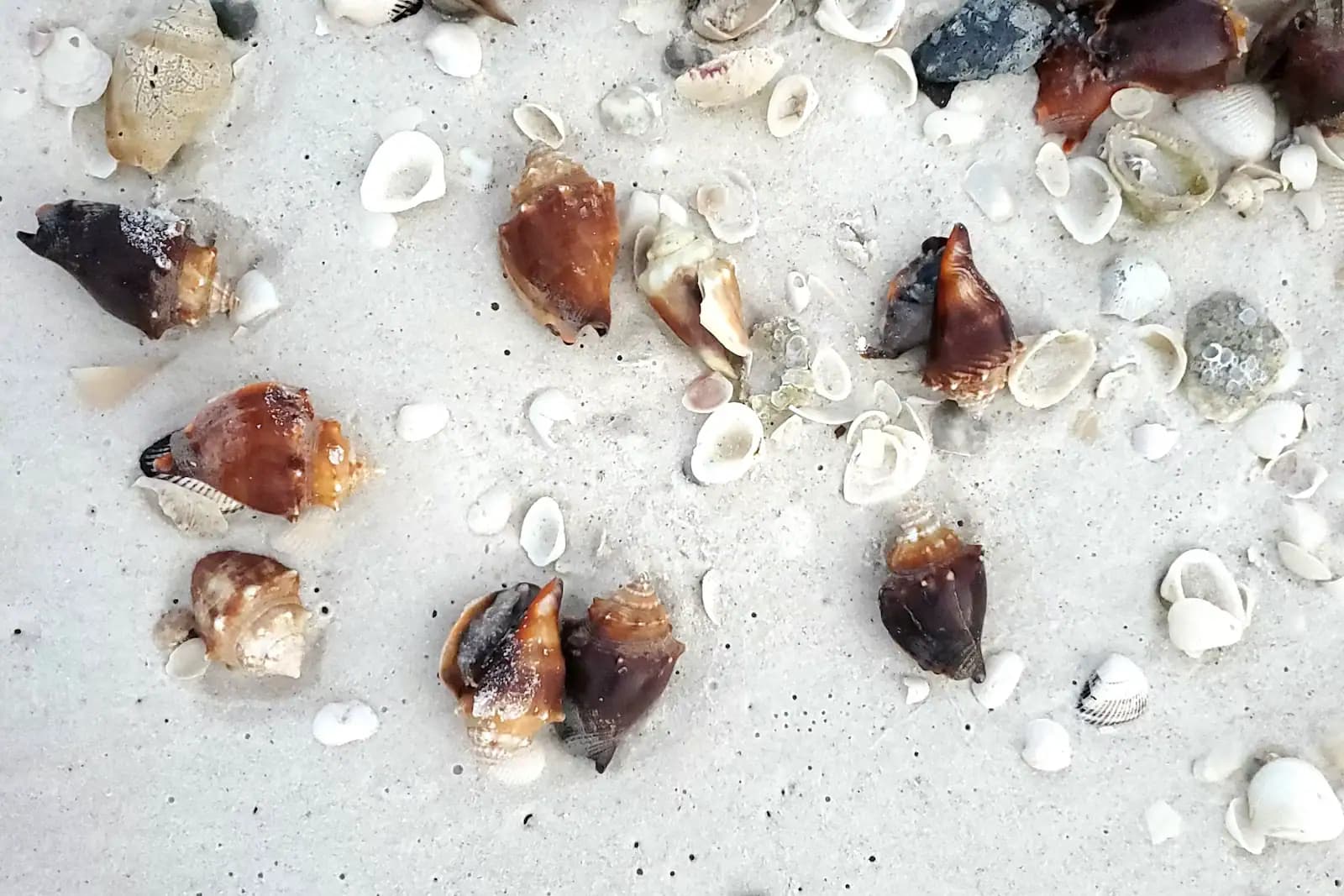
The lighthouse and Lighthouse Beach Park are the same site, so the shells, the bay-side mangrove boardwalk and the two very different shorelines are all a short walk from the tower. That is unusual — most of Sanibel makes you choose between Gulf and bay in a single stop.
Operators run these trips past The Lighthouse, or stop there as part of a longer route. We list what the booking data supports — not everything that mentions the name.
Some links below go to Viator, our booking partner. We earn a commission on bookings made through them — at no extra cost to you, and with no influence on what we recommend.

Likely to Sell Out
Join us for a Fort Myers Beach sunset cruise and enjoy a relaxing evening on the water with stunning views of the Gulf and Sanibel…
1–2 hours
Prices checked

Private and Luxury
While enjoying a complimentary alcoholic or nonalcoholic beverage we will cruise the back waters of Fort Myers Beach. During the cruise…
1–2 hours
Prices checked
Straight-line distances, so allow more on the road — the island is long and has one main parkway.

Beach
The island's east point, where the Gulf beach and San Carlos Bay meet — and the biggest beach lot on Sanibel at 162 spaces.
1.5–5 hoursBeach access is free. Parking is $5.00 per hour, enforced 24 hours a day.610 ft away

Shopping
Sanibel's main street and the birthplace of its bike path network. No traffic lights, no chain fast food, shops set back behind planting.
1–4 hoursFree. The plaza car parks along the street are free to customers.2 mi away

Landmark
Three bridges, two man-made islands, one toll charged in a single direction, and the only place you can park at the water's edge.
0.5–3 hoursToll charged island-bound only — recently around $6 with a transponder and $9 by plate. Free leaving the islands.2.5 mi away

Trail
Twenty-five-plus miles of separated paved path from the lighthouse to Blind Pass, on an island with no traffic signal to stop you.
1–5 hoursFree to use. Bicycle hire and refuge entry are separate costs.2.2 mi away
Where this place fits into a day, and the pages that plan one.

Guide hub
Sanibel lies east to west. Nearly every other barrier island on Florida's Gulf coast lies north to south, running parallel with the mainland, and…

Guide hub
Sanibel is a long, thin island with essentially two through roads, so it is easier to understand as a line than as a list. Periwinkle Way runs from…

Guide hub
The first thing to understand about a Sanibel beach is which way it points. The island lies on an east-west axis, so its Gulf shore faces south and…

Budget
Almost everything worth doing on Sanibel is free. The beaches are free. Shelling is free and requires no equipment. The interior trails are free…

Who it suits
Sanibel is a quiet island with an early bedtime, and that is either exactly what you want from a week together or the wrong choice entirely. There…

Guide
Four years on, most of the island is trading and some of it is bare ground. Here is what has actually reopened, with dates, and what has not.
9 min readHarriet Lowell

Guide
One road on, no traffic lights, metered sand and a law about what you may pick up. Sanibel rewards a visitor who understands it before they cross the bridge.
10 min readHarriet Lowell

Guide
Twelve miles of south-facing sand, seven metered car parks and a tide that decides everything. Here is which beach to pick and when.
10 min readHarriet Lowell
No. The tower is an active aid to navigation under Coast Guard control and has never been open for public climbs, before or after Hurricane Ian. The central stair cylinder starts roughly ten feet above the ground and there is no ladder, lift or guided ascent at any time of year. The grounds around the base are open around the clock and free, and the base is where the photographs are anyway — the four braced legs frame the sky in a way you cannot see from a distance.
Not the tower. Ian destroyed both keeper's cottages and every outbuilding on the site, and tore one of the tower's four legs away, but the structure was still standing the morning after the storm. The missing leg was rebuilt and the light was switched back on in the early hours of 28 February 2023. What you will not find is the pair of white stilted cottages that appear in every pre-2022 photograph. They are gone, and the site is noticeably more open and less shaded than it used to be.
It was first lit on 20 August 1884, which makes it one of the oldest structures on the island and one of the earliest lights on Florida's Gulf coast north of Key West and the Dry Tortugas. It was built to guide steamers into San Carlos Bay for the cattle port at Punta Rassa on the mainland rather than for Sanibel itself. The station was automated in 1949 and added to the National Register of Historic Places in 1974.
There is no admission charge — the grounds are public and open all hours. You will pay for parking, because the lighthouse shares its lots with Lighthouse Beach Park and every city beach lot on Sanibel charges $5.00 an hour, enforced around the clock and paid through the city's mobile system rather than a machine. If you cycle in along the shared-use path, which ends at this point, you pay nothing at all.